Tropical Storm Josephine Now: Subtropical Storm
Tropical Storm Josephine forecast path & cone map
⚠️ Model gust map, not the official forecast — NHC track & cone on top; sources & who issues warnings below the map ↓
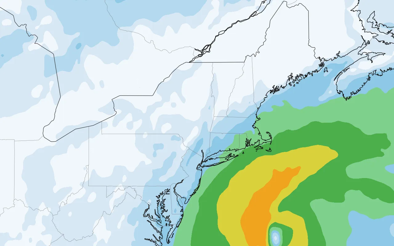
Open full map zoom in, pan, other layers
Wind gusts · GFS model — one computer model, not the official forecast.
Where could Josephine make landfall? NHC, verbatim
NHC 5-day chance of tropical-storm-force winds (39+ mph): Nantucket, MA 99% (#1) · Sable Island 92% (#1) · Hyannis, MA 66% (#1) · Montauk Point 63% (#1)
Hazards affecting land · NHC public advisory #1 · 5:00 PM AST (verbatim)
- Surf
- Large swells generated by Josephine are affecting much of the eastern seaboard of the United States and portions of Atlantic Canada. These swells are likely to cause life-threatening surf and rip current conditions. Please consult products from your local weather office.
- Wind
- Gale-force winds are possible in gusts along portions of the northeastern United States coast through Thursday. See products issued by your local National Weather Service office for more details.
Also active now

When winds arrive tropical-storm-force (39+ mph) · NHC probabilities, 5 days
| Location | Earliest TS winds could begin | Chance TS winds | Chance hurricane winds |
|---|---|---|---|
| Nantucket, MA | Wed 2 PM – Thu 2 AM | 99% | 0% |
| Sable Island | Thu 2 PM – Fri 2 AM | 92% | 6% |
| Hyannis, MA | Wed 2 PM – Thu 2 AM | 66% | 0% |
| Montauk Point | Wed 2 PM – Thu 2 AM | 63% | 0% |
| Eddy Point, NS | Thu 2 PM – Fri 2 AM | 59% | 0% |
| Cape Race Nfld | Fri 2 AM – Fri 2 PM | 57% | 2% |
| Ile St. Pierre | Fri 2 AM – Fri 2 PM | 56% | 0% |
| Yarmouth, NS | Thu 2 AM – Thu 2 PM | 54% | 0% |
| Providence, RI | Wed 2 PM – Thu 2 AM | 50% | 0% |
| Sydney, NS | Thu 2 PM – Fri 2 AM | 48% | 0% |
Time window = the earliest NHC period (AST) with a 10%+ chance that tropical-storm-force winds begin (NHC “earliest reasonable arrival” — be ready before it); “—” = under 10% in every period. Locations and percentages as published by NHC.
Watches and warnings NHC, verbatim
No coastal watches or warnings in effect.
Where is Josephine now?
ABOUT 265 MI...425 KM S OF NANTUCKET MASSACHUSETTS
ABOUT 585 MI...940 KM SW OF HALIFAX NOVA SCOTIA
Advisory timeline
- #1 · Wed 5:00 PM ASTSubtropical Storm Josephine forms · Forecast to move northeastward away from the United States — Subtropical Storm, 65 mph
Forecast discussion NHC forecaster, excerpt
At 500 PM AST (2100 UTC), the center of Subtropical Storm Josephine was located near latitude 37.4 North, longitude 69.5 West. Josephine is moving toward the north near 6 mph (9 km/h). The storm should turn northeastward by tomorrow with a large increase in forward speed. On the forecast track, Josephine should move away from the United States and remain south of Nova Scotia and Newfoundland.