Tropical Storm Trudy
Tropical Storm Trudy forecast path & cone map
⚠️ Model gust map, not the official forecast — NHC track & cone on top; sources & who issues warnings below the map ↓
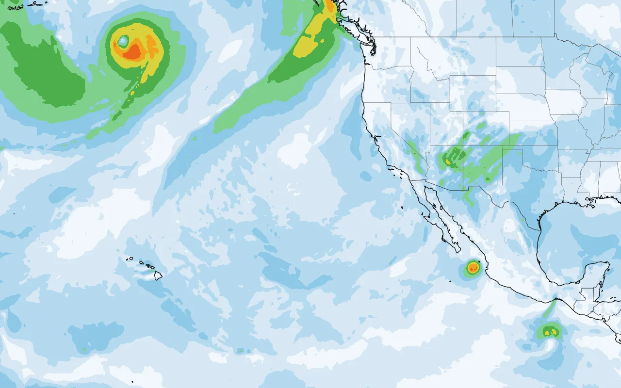
Open full map zoom in, pan, other layers
Wind gusts · GFS model — one computer model, not the official forecast.
Where could Trudy make landfall? NHC, verbatim
Key Messages · NHC Tropical Cyclone Discussion #2 · 3:00 PM CST, Tue Oct 13 (verbatim)
- Trudy is forecast to be a major hurricane as it approaches the coast of southwestern and west-central Mexico late this week and into the weekend. There is an increasing risk of wind, rain, and storm surge impacts, but it is too soon to determine the exact location or magnitude of these impacts.
NHC 5-day chance of tropical-storm-force winds (39+ mph): L Cardenas 66% (#2), 50% (#1) · Zihuatanejo 60% (#2), 38% (#1) · Manzanillo 57% (#2), 60% (#1) · Barra Navidad 38% (#2), 38% (#1)
Hazards affecting land · NHC public advisory #2 · 3:00 PM CST (verbatim)
- Surf
- Swells generated by Trudy are expected to begin affecting portions of the coast of southern Mexico late this week. These swells are likely to cause life-threatening surf and rip current conditions. Please consult products from your local weather office.
Also active now

When winds arrive tropical-storm-force (39+ mph) · NHC probabilities, 5 days
| Location | Earliest TS winds could begin | Chance TS winds | Chance hurricane winds |
|---|---|---|---|
| L Cardenas | Thu 1 PM – Fri 1 PM | 66% | 19% |
| Zihuatanejo | Thu 1 PM – Fri 1 PM | 60% | 14% |
| Manzanillo | Fri 1 PM – Sat 1 PM | 57% | 16% |
| Barra Navidad | Fri 1 PM – Sat 1 PM | 38% | 5% |
| Acapulco | Thu 1 PM – Fri 1 PM | 25% | 2% |
| Islas Marias | Sat 1 PM – Sun 1 PM | 24% | 4% |
| San Blas | Sat 1 PM – Sun 1 PM | 19% | 1% |
| P Vallarta | Sat 1 PM – Sun 1 PM | 17% | 0% |
| Mazatlan | — | 8% | 0% |
| P Maldonado | — | 5% | 0% |
Time window = the earliest NHC period (CST) with a 10%+ chance that tropical-storm-force winds begin (NHC “earliest reasonable arrival” — be ready before it); “—” = under 10% in every period. Locations and percentages as published by NHC.
Watches and warnings NHC, verbatim
No coastal watches or warnings in effect.
Where is Trudy now?
ABOUT 490 MI...790 KM SSE OF ACAPULCO MEXICO
ABOUT 780 MI...1255 KM SE OF MANZANILLO MEXICO
Advisory timeline
- #2 · Tue 3:00 PM CSTTrudy forecast to rapidly intensify to a major hurricane over the next few days · Residents of southwestern and west-central Mexico should monitor Trudy's progress — Tropical Storm, 40 mph
- #1 · Tue 9:00 AM CSTTropical depression twenty-one-e forms off the coast of southern Mexico · Forecast to rapidly intensify to a major hurricane over the next few days — Tropical Depression, 35 mph
Forecast discussion NHC forecaster, excerpt
Key messages for Trudy can be found in the Tropical Cyclone Discussion under AWIPS header MIATCDEP1 and WMO header WTPZ41 KNHC.